Fracture, Gather and Generate
“Fracture, Gather and Generate: Signifying Risk and Value in the Fractured Landscapes of North Dakota” is a project that challenges traditional boundaries of landscape architecture, bridging art, activism and radical revelation of threats to that which is intrinsically valuable. The scale of the project is boundless and seeks to solve the problem of passive acceptance of extreme extraction. Beyond conventional education and ecological regeneration, this project aims to create a culture of awareness and inquiry, both for local residents of North Dakota and tourists.
Revealing what is invisible below ground (one- to two-mile long horizontal frack lines), the proposed design tells the story of extreme fossil fuel extraction in contemporary North Dakota, asking what of intrinsic cultural and ecological value is being sacrificed for relatively short-term economic gain.
Although this study and the proposed design occur in North Dakota, the framework and application could occur anywhere extreme extraction exists, including New Mexico, Texas, Pennsylvania, Louisiana, California, Canada and beyond.
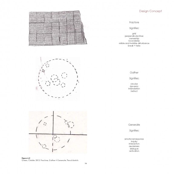
Sketch showing conceptual framework: rectilinear “fracturing” lines attributed to human elements; circular “gathering” elements attributed to non-human elements (inspired by Sage Grouse Lek) and connecting the two in the “generate” form.
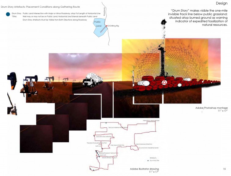
Photo montage of the proposed Drum Story in the grassland ecoregion along the 1,051-mile Gathering route, to be experienced visually along vehicular routes.
Repurposed oil drums are alternately filled with seed of vegetation from the ecoregion and water as emergency supplies for the future. Painted red and depicting “fossilized” wildlife species at risk, the drums extend above the one- to two-mile long below ground frack lines revealing extreme extraction.
Each Drum Story site includes a QR code for downloadable information about each affected ecoregion in North Dakota and its wildlife and habitat at risk.
There is also a Geocache at each Drum Story site to encourage interaction and connection.
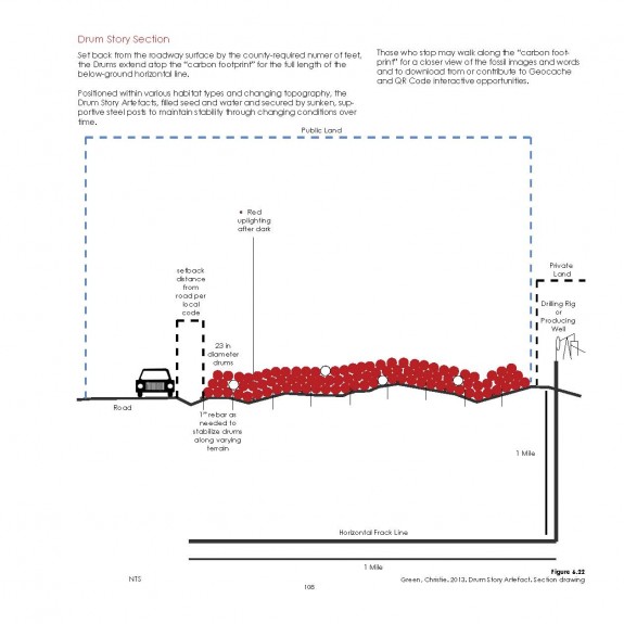
Section depicting Drum Story along vehicular route. Drums as warning indicator revealing invisible below ground frack lines.
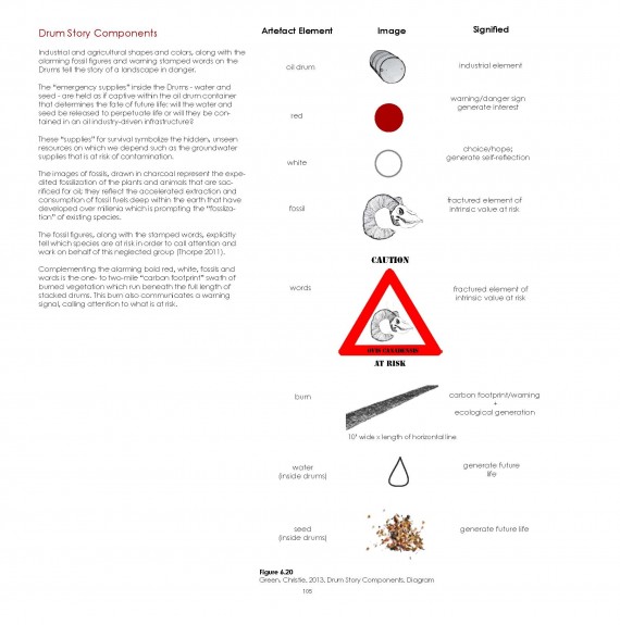
Drum Story components
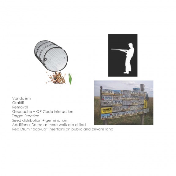
The Drum Story depends on local propensity for shooting objects. Each bullet fired at the Drums releases the water and seed as “emergency supplies” for future germination.
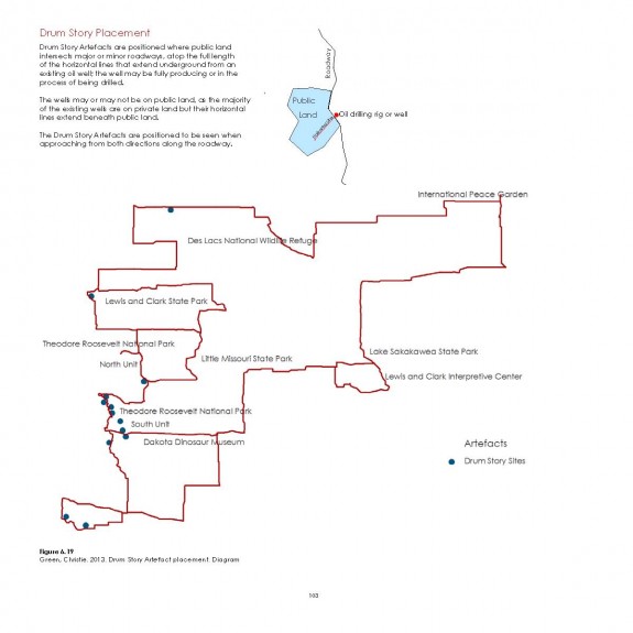
Drum Story placement along Gathering Route
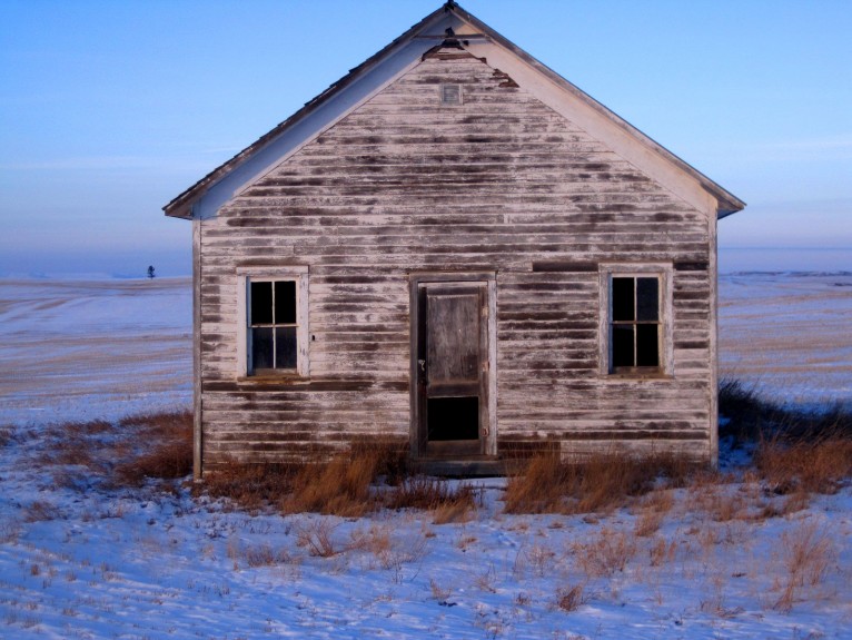
Old school house. Solitude. Silence. Winter prairie.
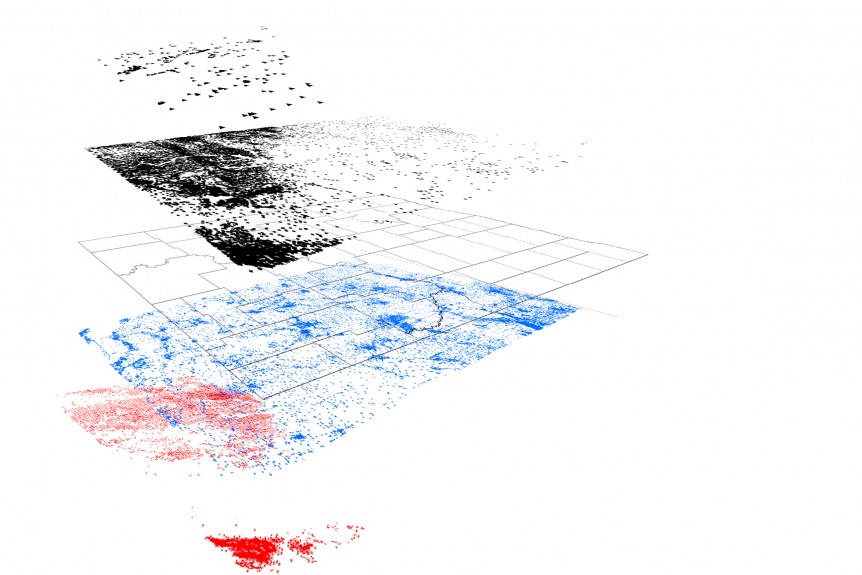
GIS layers showing oil, water and frack lines in North Dakota.
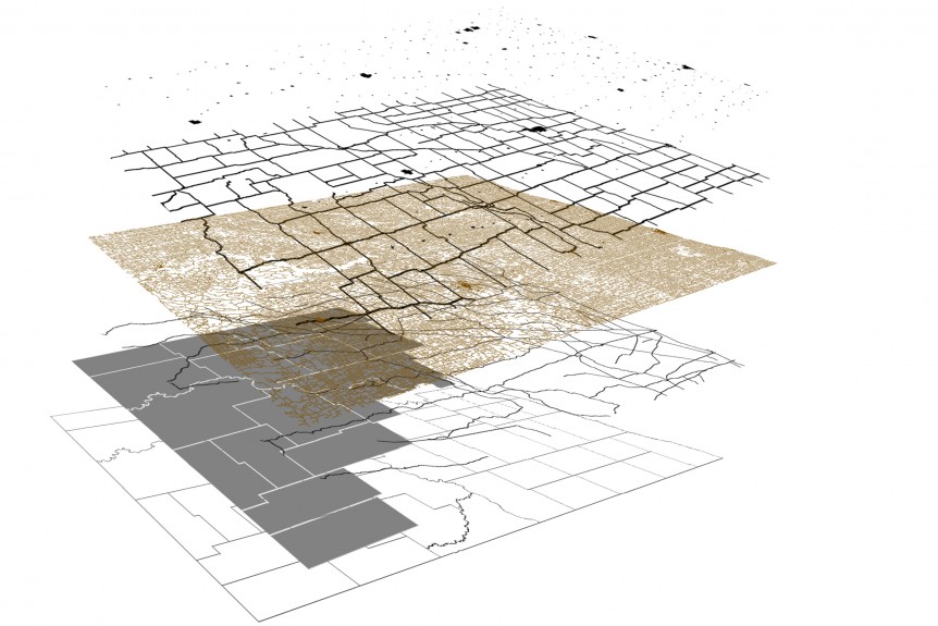
GIS layers showing cities, primary roads, secondary roads, railroad lines and the 17 oil-producing counties in North Dakota.
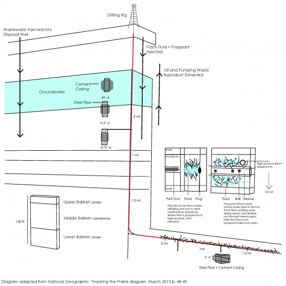
Fracking diagram. Note that both extraction of oil and gas and injection of frack waste water hinges on stability of concrete casing through multiple layers and miles of geologic formations.
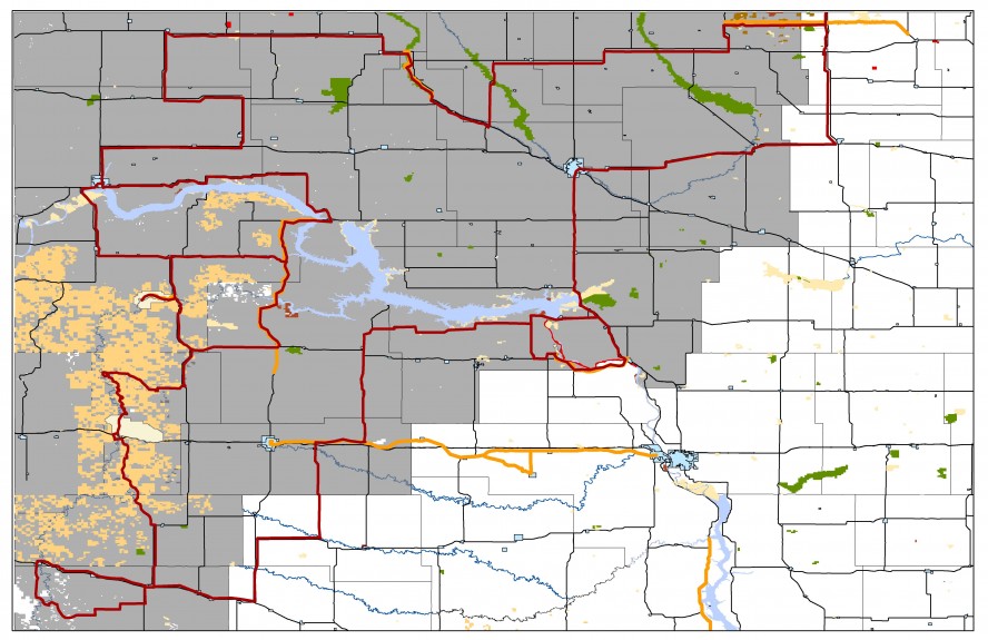
1,051-mile Gathering Route within the 17 oil-producing counties of North Dakota, intersecting vehicular routes, Scenic Byways, and recreational routes.
Screen Story, Drum Story and Story Pole insertions occur along this route.
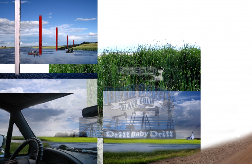
Photo montage of Story Pole along canoe trail in wetland of wildlife refuge.
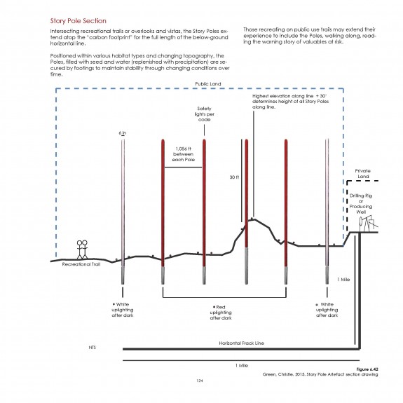
Section depicting Story Pole along recreational routes.
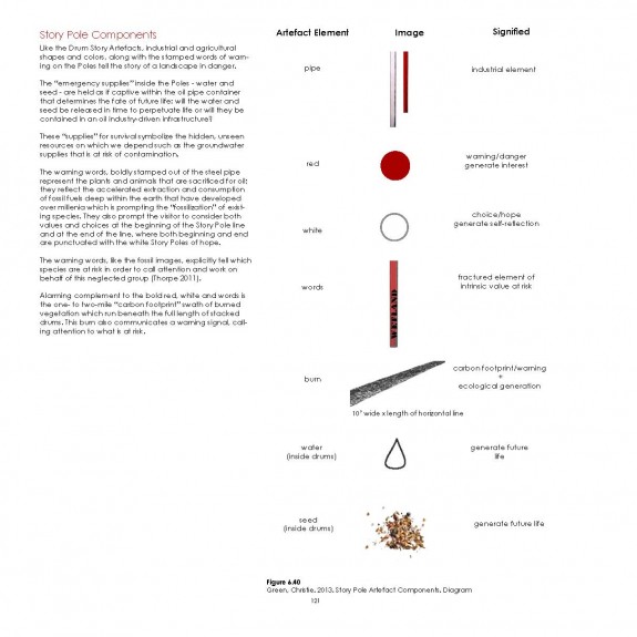
Story Pole components.
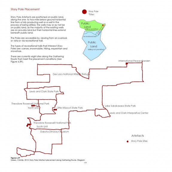
Story Pole placement along Gathering Route
A simple first version of film to include as Screen Story element at six existing film kiosks in National and State Park, interpretive center and museum visitor centers.
Updated footage and film edits underway.
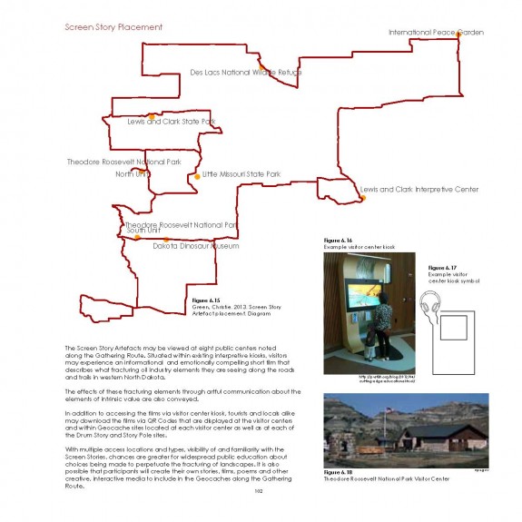
Screen Story placement within existing visitor centers.
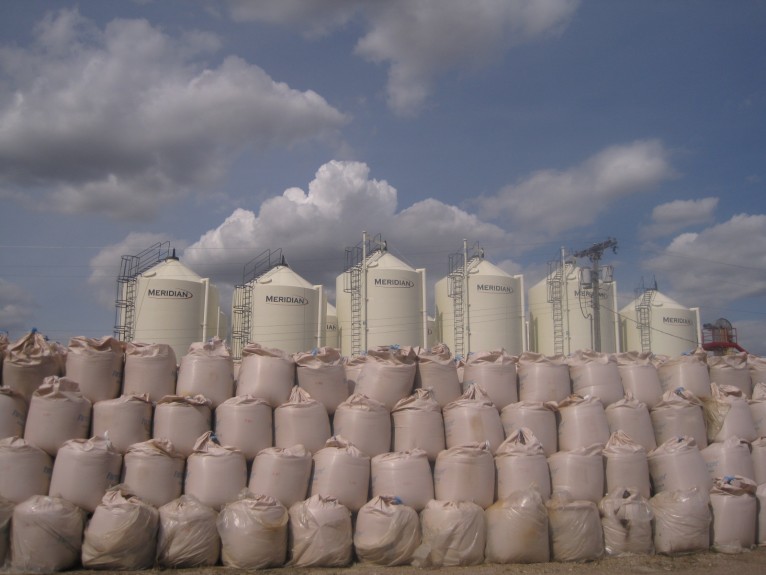
Piles of frack sand imported from Russia. Situated near Mohall, ND.
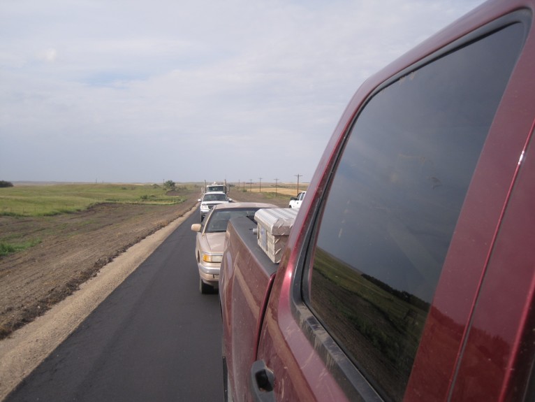
Typical traffic near boom towns.